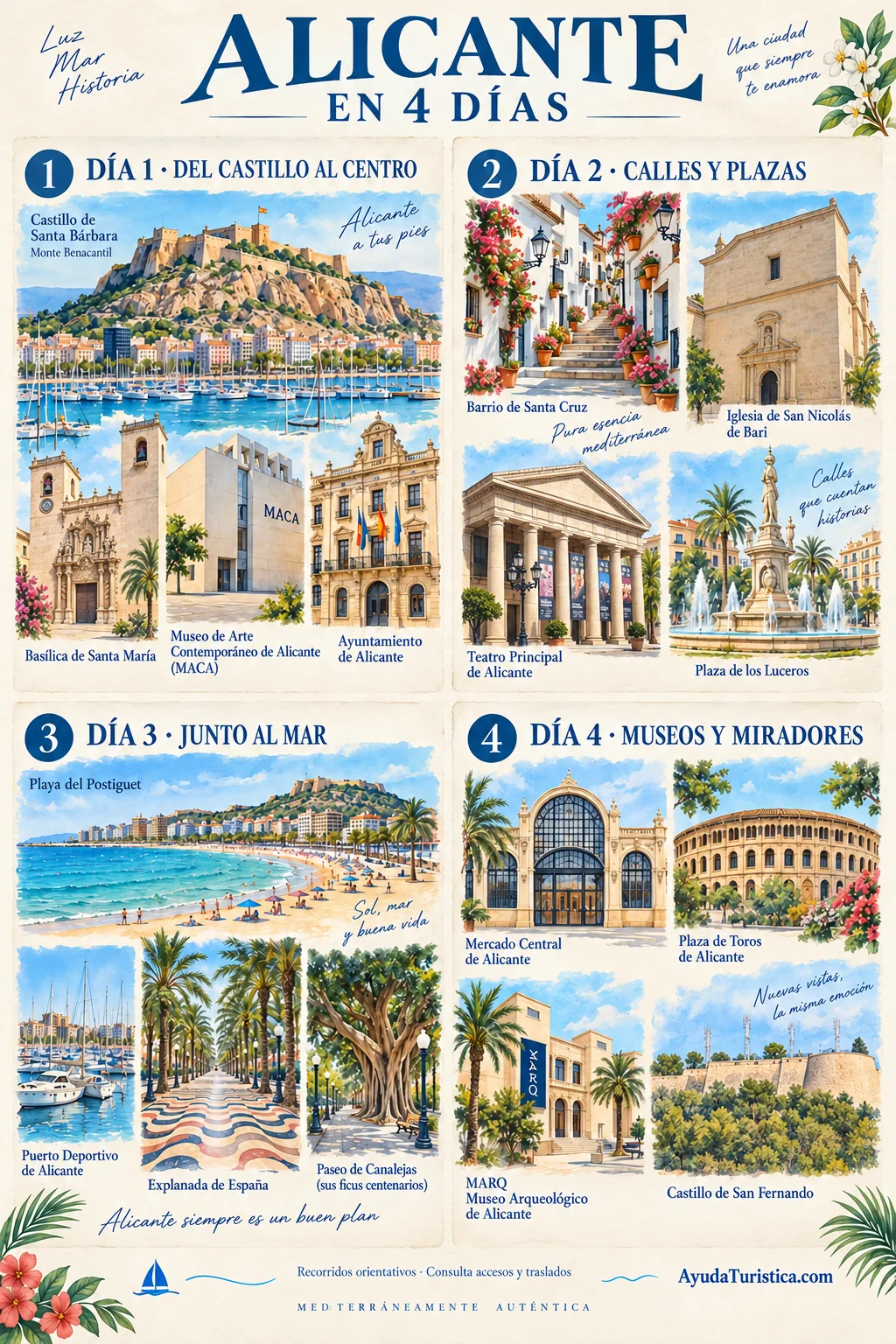
Santa Bárbara commands Alicante from Benacantil hill, and that position explains much of its history. The fortress of Muslim origin passed to Infante Alfonso of Castile on 4 December 1248, the feast day that gave the castle its name. The enclosure you see today does not belong to a single moment: successive alterations adapted its defences to different weapons and needs. Before seeking a photograph of the bay, notice how walls and platforms make use of the rock. Then identify the harbour, Postiguet beach and old town to reconstruct the relationship between defence, commerce and city. The views help organise the walk you will take below. Plan access separately: check lift operation and authorised routes, carry water and avoid a demanding climb during intense heat.
Santa María reveals a city built upon its own layers. The church was erected in the fourteenth century over the former main mosque, and its history combines Gothic architecture with later interventions, including a Baroque façade. Look at it in parts: the impression of the main front does not summarise the entire building. Notice the meeting of its volumes, towers and decorated entrance, and consider how each transformation responded to a different period. The square allows you to stand back without entering. If the interior is available, allow time to compare its space with the exterior image and respect religious services. Immediately nearby, MACA introduces a different language through contemporary art. Together, these visits show that Alicante’s heritage does not belong to a single century or one architectural style.
MACA joins recent architecture with the Casa de la Asegurada, built in 1685 as a wheat store. Turning that civic building into a place for art also tells a story about Alicante: preservation need not mean keeping the same use forever. Another essential figure is Eusebio Sempere, whose donation of the Twentieth-Century Art Collection enabled the Museo de la Asegurada to open in 1977 and provided a fundamental starting point for today’s museum. Inside, change how you look: notice rhythms, lines, materials and variations of light before searching for recognisable figures. An abstract work can raise questions without depicting a scene. Nearby Santa María invites comparison between two different cultural experiences around one square. Check available galleries and exhibitions before planning your visit, rather than assuming every collection is displayed simultaneously.
The town hall introduces eighteenth-century civic Alicante. In front of its Baroque façade, compare the repeated openings with the square: the building frames a meeting place as well as housing local government. A less obvious feature changes the scale of the visit. At the foot of the interior staircase is the reference known as Cota Cero, associated with measuring elevations. This is a technical reference point, rather than a floor or viewpoint. Check access arrangements before entering to look for it; administrative activity may affect admission. You can study the exterior and its relationship with the square without visiting the offices.
Santa Cruz makes sense when explored slowly along the Benacantil slope, where houses, steps and narrow streets adapt to the terrain. Its appeal is not an isolated monument but the way everyday life occupies difficult ground. Flowerpots and façades belong to an inhabited neighbourhood, not a stage arranged only for visitors. Each spring, the May Crosses celebration strengthens this community identity through floral decorations made by residents. The chapel and viewpoint help place the old town in relation to the harbour and Mediterranean. Listen to how the atmosphere changes as you leave the busiest streets behind. Stop without blocking steps, avoid photographing private interiors and allow for the descent. Do not assume a step-free itinerary or direct castle access from any street you choose; follow the authorised routes and local indications.
San Nicolás brings monumental scale to the old town’s streets, but its interest does not depend on an overloaded façade. Construction of the present church began in 1616 over an earlier medieval building, and its long development explains the coexistence of different artistic periods. The collegiate church became a co-cathedral in 1959, when the diocese took the name Orihuela-Alicante. First observe the restrained volumes and then the dome, which helps identify the building from other parts of the city. If you can enter, compare the change of light and proportions with the street you have just left. There is no need to rush through everything: give one space and its details your attention. Visits must accommodate worship and available access; confirm current arrangements before planning an interior visit.
The Principal opened in 1847 as Teatro Nuevo, designed by Emilio Jover. Its history introduces the initiative of Alicante’s commercial bourgeoisie and cultural life alongside the port and fortifications. From outside, study the portico as a transition between street and performance. The sequence of vestibule, stairs and auditorium prepares the audience’s arrival; the horseshoe layout belongs to the Italian theatre tradition. Understanding that sequence gives an interior visit a purpose beyond looking at the stage. Check the theatre’s programme or guided visits before going: attending a performance and taking an architectural tour are different experiences.
Luceros helps you navigate the city beyond the old centre. Alfonso el Sabio, Estación, Federico Soto and General Marvá avenues meet here. Daniel Bañuls designed the fountain, inaugurated in 1931, which gives the junction its identity. Look at the composition as a whole, then pick out the figures breaking the outline of the pedestal: sculpture and water offer different impressions from different angles. The avenues extending away from the square are part of the stop, rather than merely a backdrop to a close photograph. Observe from pedestrian areas and use designated crossings; do not step into traffic to approach the monument.
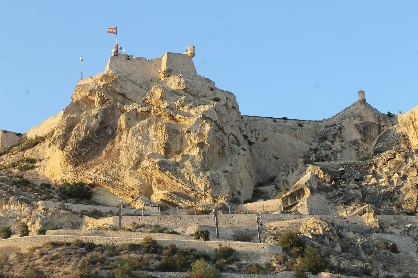
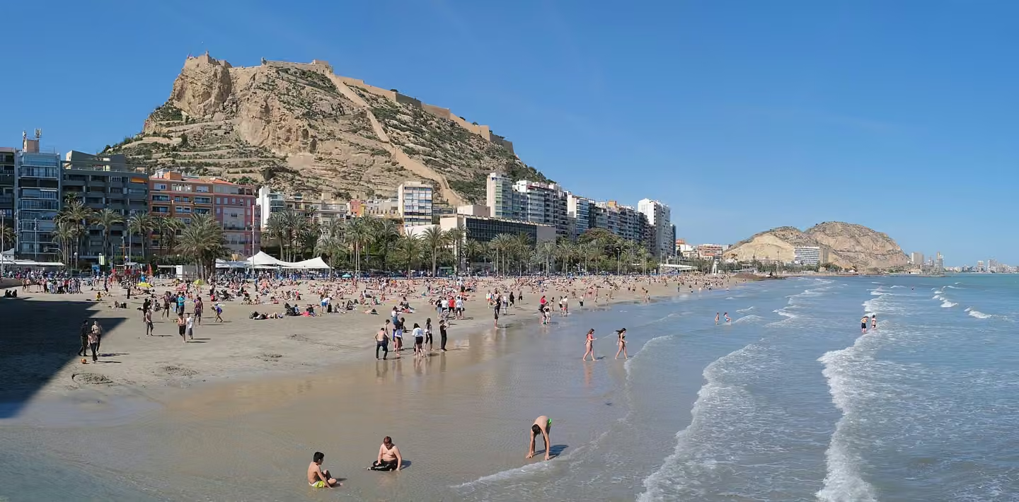
Postiguet helps you read Alicante as a city connected to its beach: Benacantil and Santa Bárbara rise behind it, with the old centre and Explanada nearby. Walk along Gómiz promenade and notice how the castle's outline changes beside the water. Look down as well: the arrangement of the paving creates an impression of depth, adding another visual detail beyond the horizon. You can include this stop without planning to swim; a short waterfront walk fits into a visit to the centre. Before entering the sea, check the flag and that day's conditions. Do not assume summer facilities or assisted bathing services operate outside their season.
The harbour explains why Alicante faces the Mediterranean while remaining connected to the peninsula’s interior. Exports of Castilian wool and trade links with Italy helped establish its importance, using the Vinalopó corridor towards the plateau. In 1803, an initial Port Works Board was formed, reflecting the need to organise and improve its facilities. Today the waterfront brings together different activities: commercial navigation, pleasure boats and public promenades. Study the relationship between quays, water and city buildings instead of concentrating only on the boats. The landscape reveals economic and urban change. Walk within authorised public areas; terminals, embarkation points and working zones have separate access arrangements. A boat excursion requires checking the operator, departure point, return arrangements and sea conditions rather than assuming that every service leaves from the same quay.
The Explanada turns the edge of the harbour into a place for walking and looking. Beneath the palms, three colours of marble form waves: compare the pattern close up with the perspective along the promenade. The paving suggests the sea within an urban space. Look for La Concha, the outdoor stage, which adds a performance setting to the walk. Its presence does not mean a concert will take place during your visit; consult the programme if you want to attend. Continue towards Canalejas to compare a promenade defined by its paving with a garden where vegetation changes the experience.
Canalejas changes the rhythm of the waterfront walk: after the Explanada’s patterned paving, attention shifts to the trunks and canopies of large ficus trees. González Altés designed the park in 1886, and it bears José Canalejas’s name. Look for the stone lions and the monument to Carlos Arniches as landmarks for exploring, rather than treating it only as somewhere to rest. Alternate between these details and the garden’s relationship with the waterfront. This can be a pause before continuing towards the harbour. Shade changes during the day; choose your route according to the heat and your group’s needs.
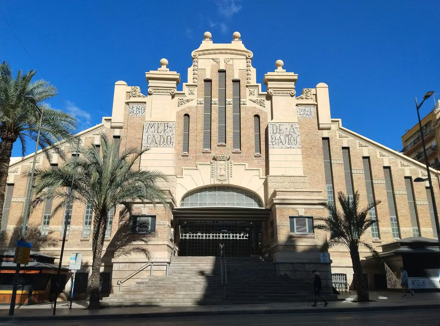
The Central Market brings together architecture, food supplies and collective memory. The Municipal Archive dates the opening of the present building to 21 November 1922, during the modernisation of Alicante’s markets. Its history cannot be separated from the bombing of 25 May 1938, when the attack on this area killed hundreds of civilians; the square behind retains that date in its name. Look at the façade and entrances before going inside, then observe how stalls and circulation are arranged. Produce introduces local habits, but people are still working and shopping here: ask before taking close photographs and keep passageways clear. The visit matters both for the building and its everyday function. Check trading hours, which are not equivalent to those of a continuously open visitor attraction, and adapt your walk accordingly.
The bullring reveals two stages of nineteenth-century Alicante. Emilio Jover began construction in 1847; José Guardiola Picó undertook an almost complete reconstruction from 1884. The rebuilt arena was inaugurated in June 1888, so a single date cannot explain the whole building. The enlargement added a second storey and external entrances and stairs. Notice how a venue gathering a crowd must distribute access as well as present a recognisable façade. You can make this an exterior architecture stop. Check visits and programming separately if you wish to enter; neither interior admission nor a particular event should be assumed.
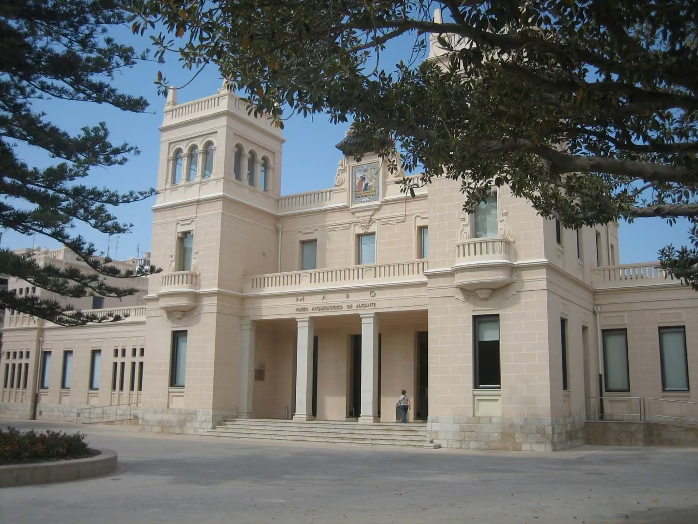
MARQ introduces the Alicante region through what people left behind. Its permanent galleries cover Prehistory, Iberian culture, the Roman world, the Middle Ages and modern and contemporary periods. This is more than a succession of ancient objects: archaeology connects things, places and questions about everyday life. The building adds another layer because it occupies the former Provincial Hospital of San Juan de Dios, designed by Juan Vidal Ramos. Once inside, choose an object that catches your attention and imagine how it was made, used and eventually preserved. Then compare materials and techniques across periods. That approach turns dates into human stories. Check current exhibitions and admission arrangements; visiting the museum does not automatically include archaeological sites associated with the institution, which require their own journey and access arrangements.
San Fernando stands on Tossal and belongs to Alicante's defences during the Peninsular War. Its irregular layout follows the terrain: look for walls using the rock and strengthening vulnerable points, rather than a symmetrical fortress. The municipal description identifies differently shaped bastions and a ditch restricted to the section requiring that protection. Reading the ground gives the visit a purpose and offers a comparison with Santa Bárbara without confusing the two sites. Before climbing, consider the effort involved and carry water; this is a hilltop stop. Check permitted access and do not assume an interior tour is available. Study the defences from authorised spaces, keeping away from edges when taking photographs.