
SAN SEBASTIÁN · AYUDA TURÍSTICA
San Sebastián tourist map and printable PDF walking guide
Need a street map or a prepared walk?
These are different resources: the official map helps you find streets; our guide proposes a particular Old Town walk.
A walking guide to save and print
Two pages with four stops, practical choices, sources and a QR to the interactive map. Includes our own orientation diagram, not a street map or an accessibility-audited route.
Download the PDF walking guidePDF · English · 2 pages · 85 KB
Save the PDF before leaving. You can read it offline; its QR, web maps and linked directions require internet.
Official city map and practical transport connections.
Official tourist street map offered by Donostia San Sebastián Turismoa (PDF updated in October 2025). For the current rail network and service changes, use Euskotren; for city buses, Dbus.
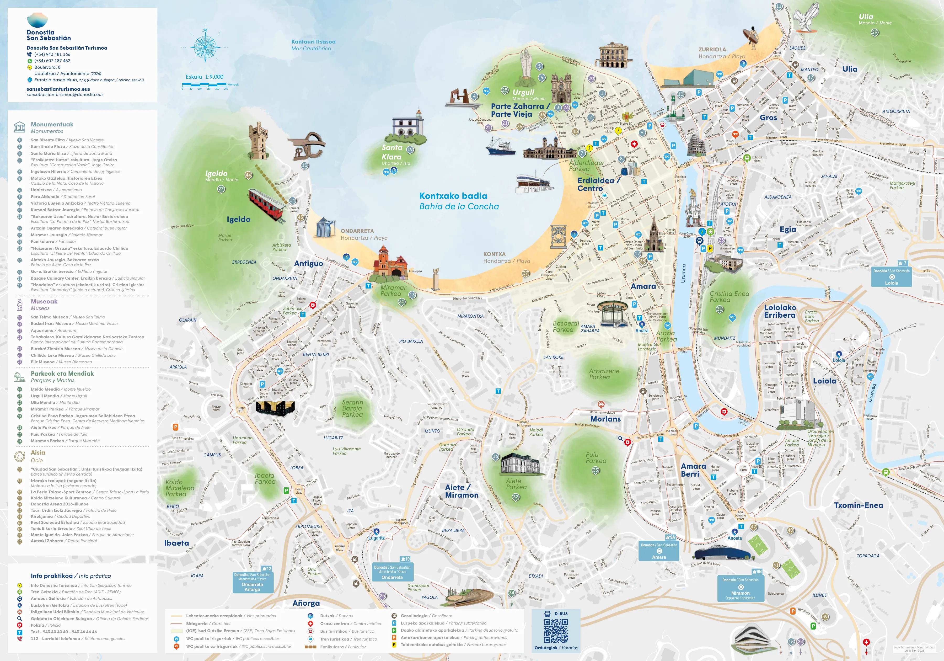
Enlarge map · Original official PDF
Source: Donostia San Sebastián Turismoa
How to use the Donostia map
Use the tourist plan on this page for sightseeing on foot and the operator’s map for a bus or train. A city plan does not confirm timetables or service changes.
Save the plan before leaving
Open the official PDF and save it on your phone for use without reception. Check that the download has finished: the link opens a large external file. This page’s image is a preview; use the PDF to zoom into details.
From map to walk
Locate your accommodation and starting point first. Then choose a city walk and check entrances before setting out. The routes have not been audited for accessibility.